March 4, 2021 · 1 min read
Tajikistan Geography
Nestled between Kyrgyzstan and Uzbekistan, Tajikistan lies to the north of Afghanistan and to the south and east of China.
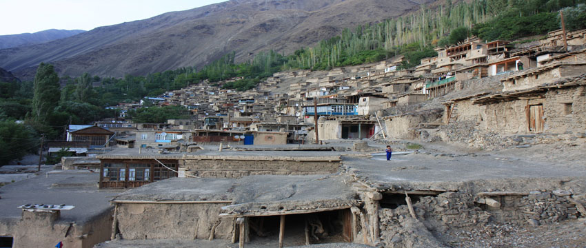
The icy pinnacles cover 93 per cent of Tajikistan's total area. Separating Tajikistan's two population centres, the northern Fergana Valley and the lowlands of the southern Panj River, the Mountainous terrain of Tajikistan are a beautiful geographical mention.
Geographical Features Of Tajikistan
Mountains
Ground to some of the highest mountains in the world, Tajikistan boasts its Pamir and Alay ranges among sought-after vacation destinations. With peak altitudes ranging from 300 m above sea level to almost 7,500 m above sea level, 93% of Tajikistan is mountainous and approximately 50% of Tajikistan's land region is above 3,000 m above sea level.
The extensive mountain ranges are also cut by hundreds of gorges and canyons at the bottom of which run sleek, crystal, clear streams flowing into valleys.
These valleys are dotted with local Tajik people that form the major part of the country's population who work and live in these regions efficiently.
The Pamir Mountains are profoundly glaciated and are home to the Fedchenko Glacier, the largest non-polar glacier not only in Tajikistan but also in the world.
Rivers
The Amu Darya and the Syr Darya, the most important rivers of Central Asia flow through Tajikistan. The two rivers fed by glaciers and melting snow from the mountains of Kyrgyzstan and Tajikistan form the distributary for most of the other smaller rivers flowing through both the countries.
There are more than 900 rivers in Tajikistan that stretch over more than 10 kilometres.
The Largest Rivers Of Tajikistan Are:
Amu Darya/Panj
Bartang
Gunt
Muksu
Kofarnihon (Kafirnigan)
Kyzylsu
Oksu
Murghab
Obihingou
Vakhsh/Surkhob
Vanj
Yazgulyam
Zeravshan
Syr Darya
Surkhandarya
Lakes In Tajikistan
About 2% of Tajikistan's area is covered by lakes. Some of the largest are listed below.
Bulunkul (Pamir)
Drumkul (Pamir)
Karakul (Tajik: Qarokul; eastern Pamir)
Rangkul (Pamir)
Sarez (Pamir)
Sasykkul (Pamir)
Shadau Lake (Pamir)
Shorkul (Pamir)
Turuminzifatravel.comaikul (Pamir)
Tuzkul (Pamir)
Yashilkul (Pamir)
Zorkul (Pamir)
Kayrakum (Qairoqqum) Reservoir (Sughd)
Iskanderkul (Fann Mountains)
Kulikalon (Kul-i Kalon) (Fann Mountains)
Nurek Reservoir (Khatlon)
Area And Boundaries
Area:
total: 143,100 km2
land: 141,510 km2
water: 2,590 km2
Land Boundaries:
total: 3,651 km
border countries:
Afghanistan 1,206 km
China 414 km
Kyrgyzstan 870 km
Uzbekistan 1,161 km
Coastline: 0 km (landlocked)
Elevation Extremes:
lowest point: Syr Darya 300 m (980 ft)
highest point: Ismoil Somoni Peak 7,495 m (24,590 ft)
Other peaks include: Lenin Peak 7,134 m
Peak Korzhenevskaya 7105 m
Independence Peak6,974 m
Resources And Land Use
Natural resources: hydropower, lead, zinc, antimony, tungsten, silver, gold, some petroleum, uranium, mercury, brown coal
Land Use:
arable land: 6%
permanent crops: 1%
pastures: 21%
non-agricultural land: 72%
including forests and woodland: 3%
Irrigated Land:
7,235 km2 (2,793 sq mi)
Total renewable water resources: 99.7 cubic km